Coasts
|
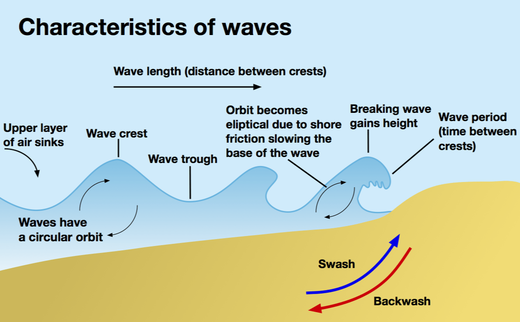
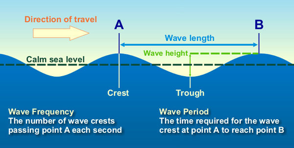
The highest surface part of a wave is called the crest, and the lowest part is the trough. The vertical distance between the crest and the trough is the wave height. The horizontal distance between two adjacent crests or troughs is known as the wavelength.
Wave height is affected by wind speed, wind duration, or how long the wind blows, and fetch, which is the distance over water that the wind blows in a single direction. If wind speed is slow, only small waves result. If the wind speed is great but it only blows for a few minutes, no large waves will occur. Also, if strong winds blow for a long period of time but over a short fetch, no large waves form. Large waves occur only when all three factors combine (Duxbury, et al, 2002.) |
A coastal zone is the interface between the land and water. These zones are important because a majority of the world's population inhabit such zones. Coastal zones are continually changing because of the dynamic interaction between the oceans and the land.
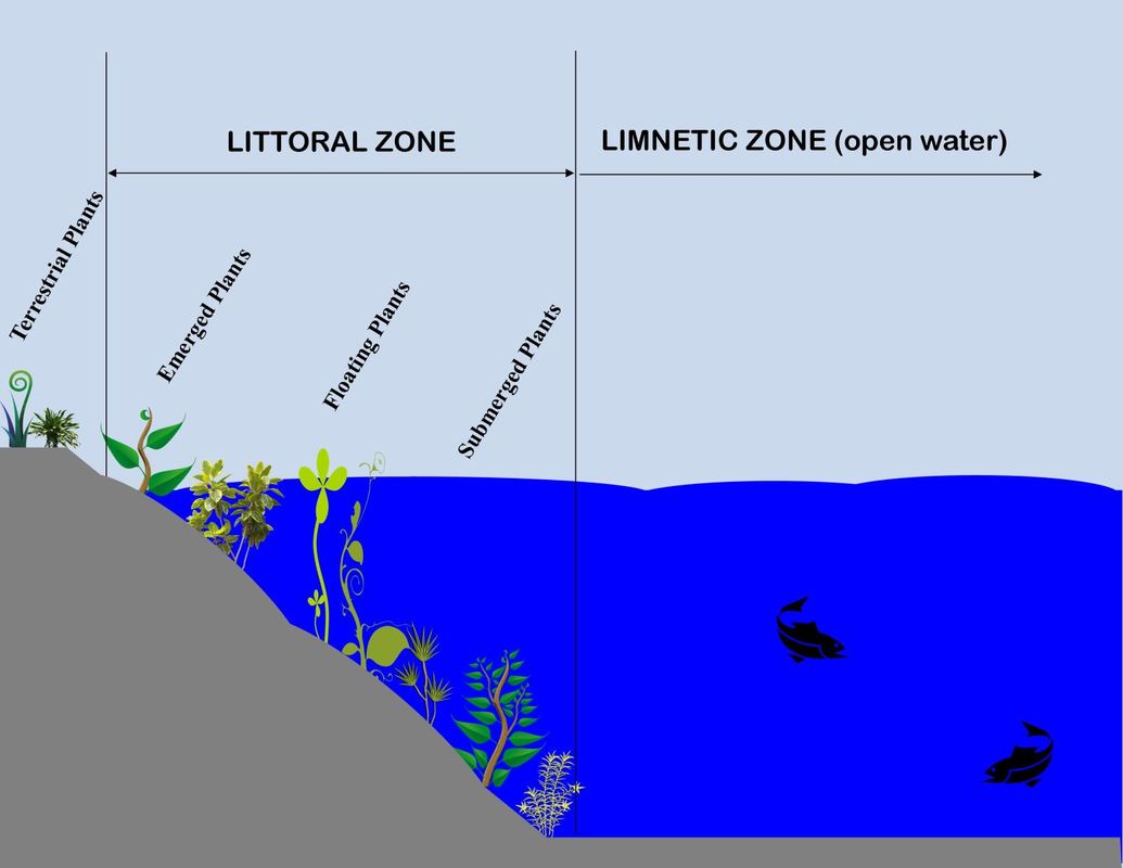
The littoral zone is the near shore area where sunlight penetrates all the way to the sediment and allows aquatic plants (macrophytes) to grow. Light levels of about 1% or less of surface values usually define this depth. Over 70 percent of the planet's surface is covered by water, the majority of which is in the world's seas and oceans. Half the world's population lives within 60 km of the sea, and three-quarters of all large cities are located on the coast. |
|
|
|
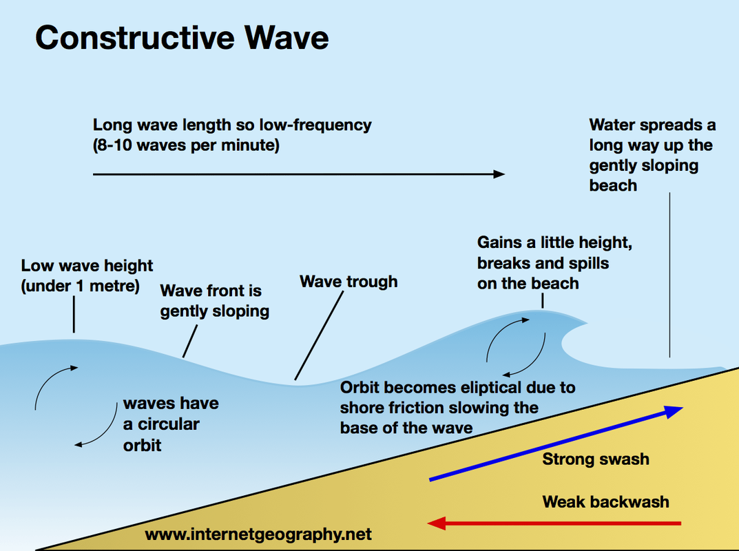
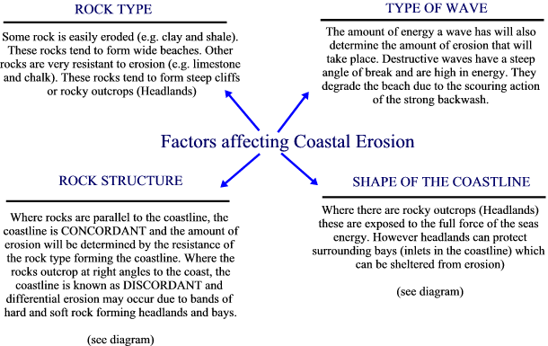
Constructive WAvesSmall oceans with small fetch develop constructive waves. Constructive waves have low wave height and long wave length with low frequency, between 6 and 8 waves per minute. Constructive waves are associated with weak backwash and strong swash, which builds up wide flat beaches and so more associated with coasts of deposition. Constructive waves also tend to form sandy beaches.
|
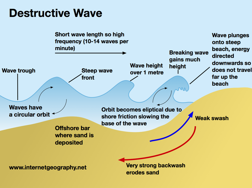
Destructive wavesLarge oceans with large fetch produce large waves, called destructive waves. These waves have large wave height and short wave length and are characterised by tall breakers that have high downward force and a strong backwash. They have high frequency, over 10 waves per minute. This downward energy helps erode clifs. In addition, due to a dominant backwash they erode the beach making for narrow steep beach profiles. Localised storms with high wind speed also form destructive waves as well as steep depth gradients around headlands. Destructive waves also tend to form pebbly beaches.
|
Tides
|
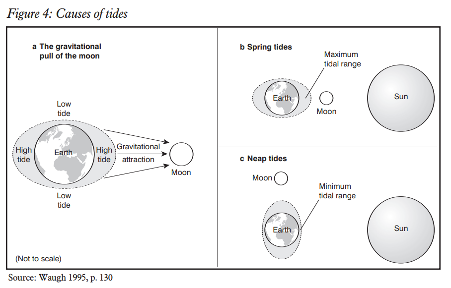
The ocean’s tides are controlled by the gravitational pull of the Moon, and to a lesser extent the Sun. The Moon pulls the water in the ocean towards it, creating a bulge of water; a high tide. The Moon not only pulls the water but also pulls the Earth towards it, this creates a second bulge of water and the second high tide on the other side of the Earth. Twice a month the Earth, Moon and Sun are aligned: this puts an extra gravitational pull on the tidal bulge, to produce an extra high tide called a spring tide.
When the Sun and Moon are at right angles to each other, neap tides occur, when the tidal range is lowest. Figure 4 shows the influence of the Moon and Sun on the Earth’s tides. When a spring tide coincides with an onshore gale, a storm surge can occur, which can lead to exceptionally high seas and flooding, as in the East coast floods of 1953 and the ‘near miss’ of November 2007. The tidal range is the vertical distance between high tide and low tide, and this coincides with the sweep zone for the September 2008. The slope of the shoreline and the tidal range determine the amount of shore exposed to wave action A low tidal range tends to produce a narrower beach, which is prone to higher erosion; such beaches are found on the shores of seas such as the Mediterranean, rather than oceans. Higher tidal ranges are found on ocean coasts, such as the Atlantic coasts of Britain and Canada |
|
Types of Erosion
Sediment transportation
|
Longshore Drift (littoral drift)
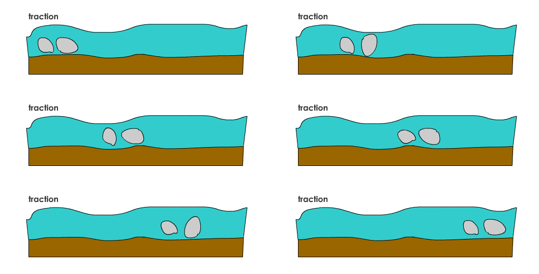
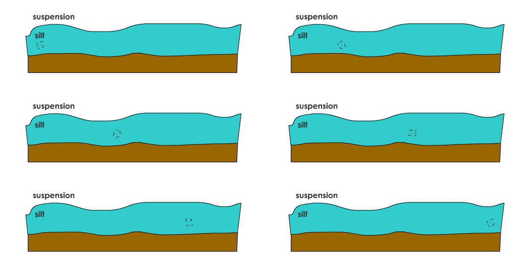
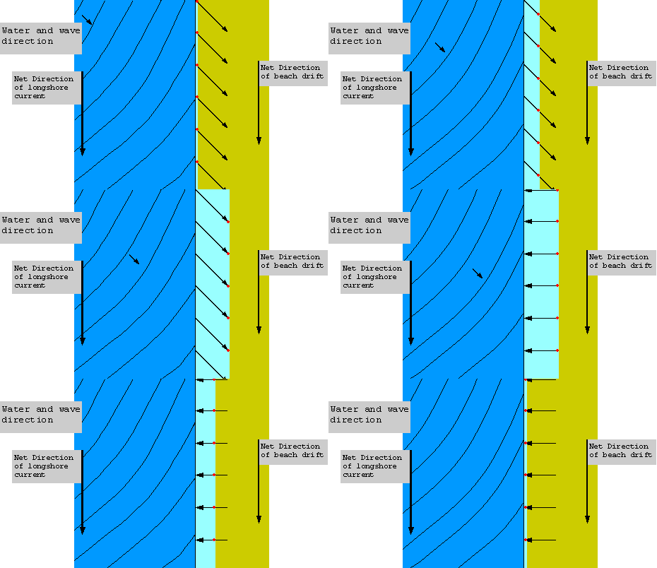
Longshore drift is a process responsible for moving significant amounts of sediment along the coast. This usually occurs in one direction as dictated by the prevailing wind. For example, the prevailing wind along the Holderness Coast is north-easterly. As the result waves break on to the beach obliquely at an angle of around 45 degrees. The swash moves beach material along the beach and the backwash, under gravity, pulls the material back down the beach at right angles to the coastline. Over time this creates a net shift of material along the coast. |
|
|
|
Your browser does not support viewing this document. Click here to download the document.
| geofile_575_coastal_systems.pdf | |
| File Size: | 175 kb |
| File Type: | |
Cliff structure
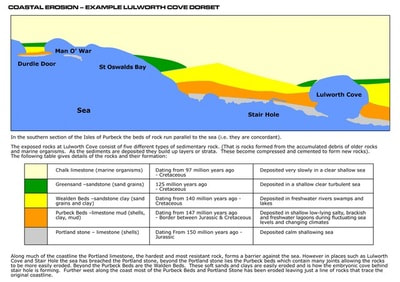
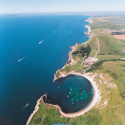
Concordant CoastsA concordant coast occurs where beds, or layers, of differing rock types are folded into ridges that run parallel to the coast. The outer hard rock (for example, granite) provides a protective barrier to erosion of the softer rocks (for example, clays) further inland. Sometimes the outer hard rock is punctured, allowing the sea to erode the softer rocks behind. This creates a cove, a circular area of water with a relatively narrow entrance from the sea.
|
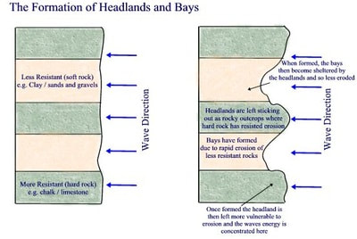
Discordant coastsA discordant coastline occurs where bands of different rock type run perpendicular to the coast.
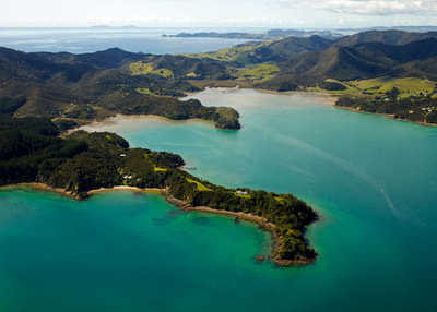
The differing resistance to erosion leads to the formation of headlands and bays. A hard rock type such as granite is resistant to erosion and creates a promontory whilst a softer rock type such as the clays of Bagshot Beds is easily eroded creating a bay. |
Wave cut platform
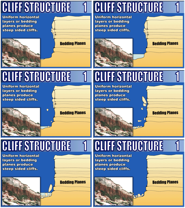
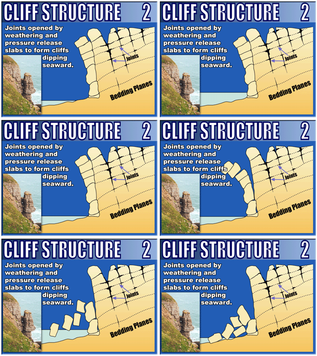
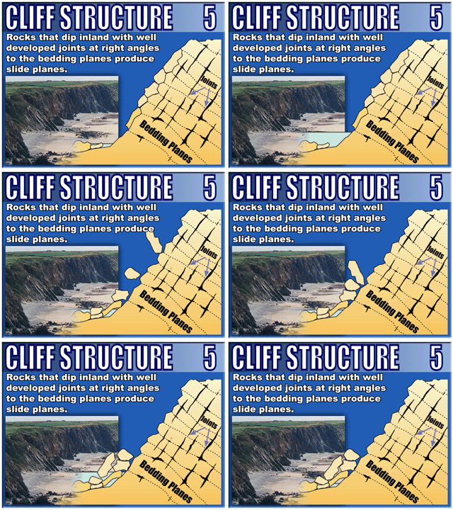
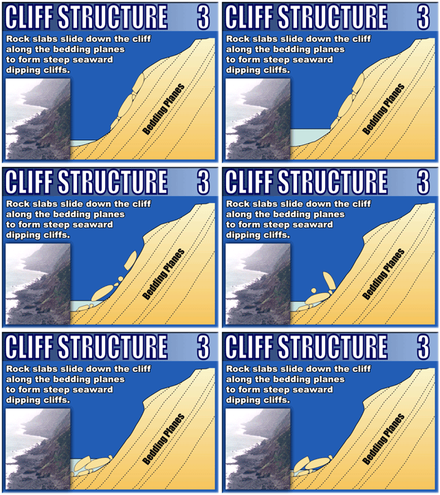
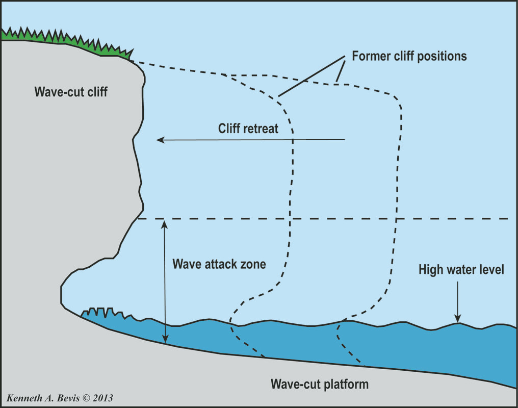
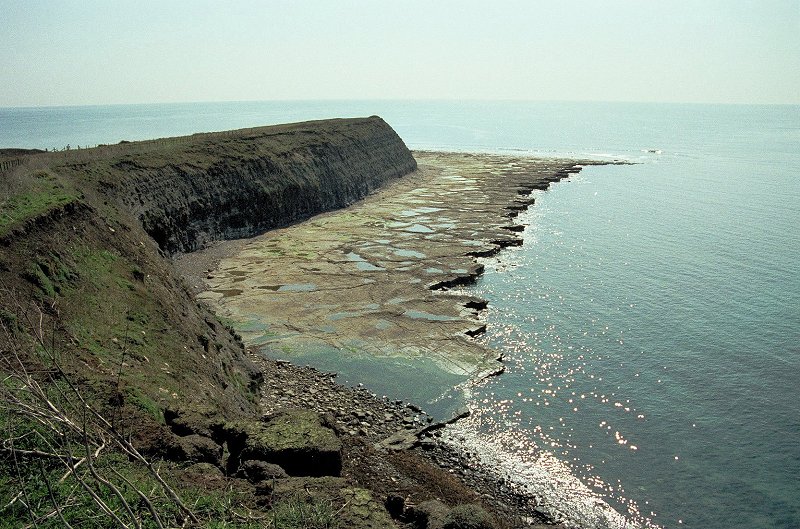
One of the most common features of a coastline is a cliff. Cliffs are shaped through a combination of erosion and weathering - the breakdown of rocks caused by weather conditions.
Soft rock, eg sand and clay, erodes easily to create gently sloping cliffs. Hard rock, eg chalk, is more resistant and erodes slowly to create steep cliffs.
Forming a wave cut platform
Soft rock, eg sand and clay, erodes easily to create gently sloping cliffs. Hard rock, eg chalk, is more resistant and erodes slowly to create steep cliffs.
Forming a wave cut platform
- Weather weakens the top of the cliff.
- The sea attacks the base of the cliff forming a wave-cut notch.
- The notch increases in size causing the cliff to collapse.
- The backwash carries the rubble towards the sea forming a wave-cut platform.
- The process repeats and the cliff continues to retreat.
Caves, Arches, Stacks and Stumps
|
|
|
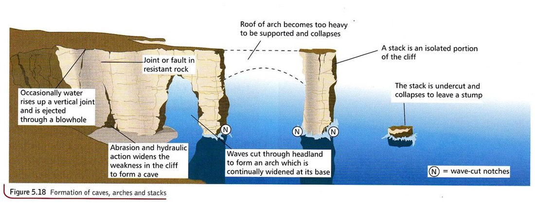
Stages of formation:
- Headlands can have areas of weakness (cracks) which are the focus of wave erosion.
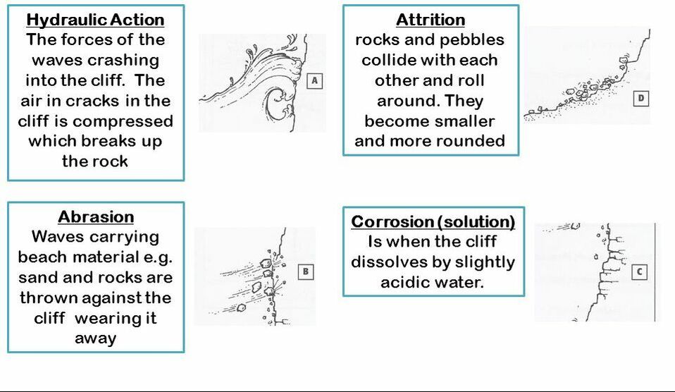
- Hydraulic action and abrasion widens cracks until they form a cave.
- Caves grow until they cut through the headland and form an arch.
- The roof of the arch is prone to weathering and will eventually collapse leaving behind a stack
- The stack is eroded near its base and wave but notches will gradually destabilize it.
- Eventually the stack will collapse leaving behind a stump.
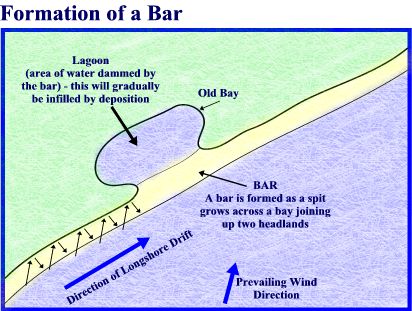
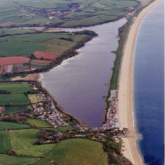
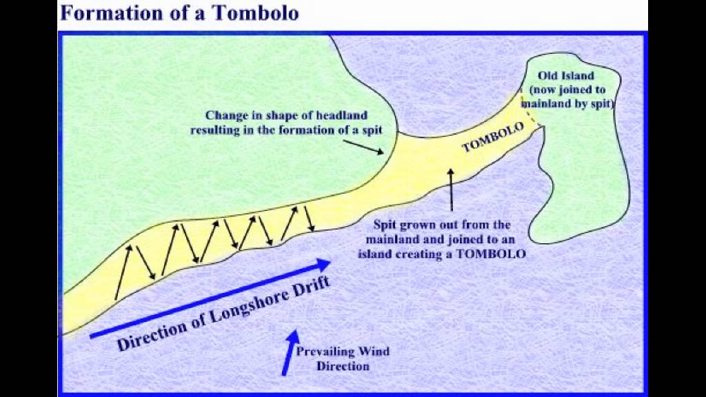
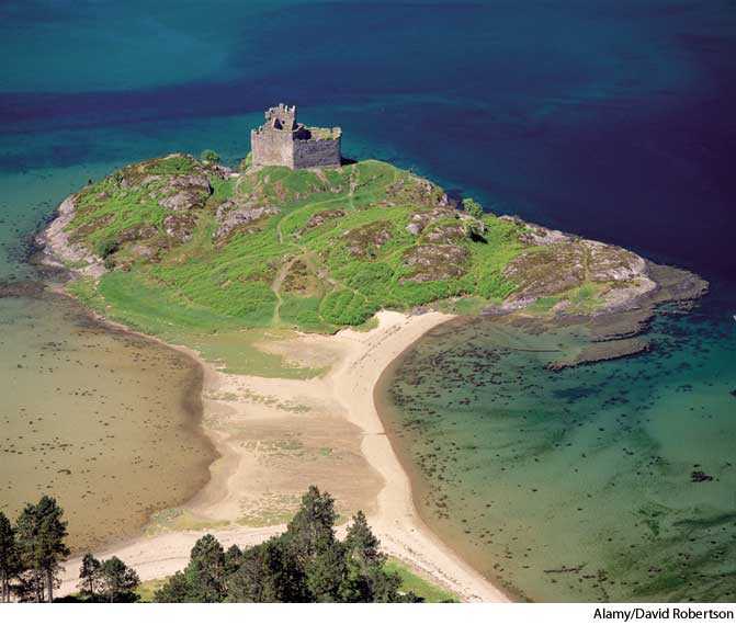
Coastal Spits, Bars & Tombolos
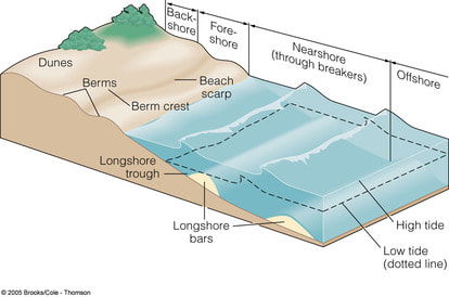
Beaches and Sand Dunes
How do coastal sand dunes form?
Dunes are formed when wind and waves transport sand onto the beach. The ultimate source of the sand is often glacial till that resides offshore, or is eroded from nearby cliffs by waves and transported along the shoreline by longshore currents (see coastal sediment processes). Rivers can also transport sand to the coast from inland deposits. Waves wash this sand up on the beach, and also remove it during storms.
One beach can vary quite substantially with the seasons. During the winter, stronger waves pick up more sand (but leave behind larger sediment), causing the beach to be steeper and coarser. In summer, gentle waves transport sand onshore and the beach takes on a shallower slope with finer sand.
The shape and size of dunes formed depends on the shape of the beach. On a shallow-sloped beach, the energy of waves is dissipated and the suspended grains of sand are deposited, resulting in greater dune potential. Steeper beaches do not dissipate this energy as well, and sand is more frequently washed back out to sea. Consequently, dunes on steeper beaches are smaller.
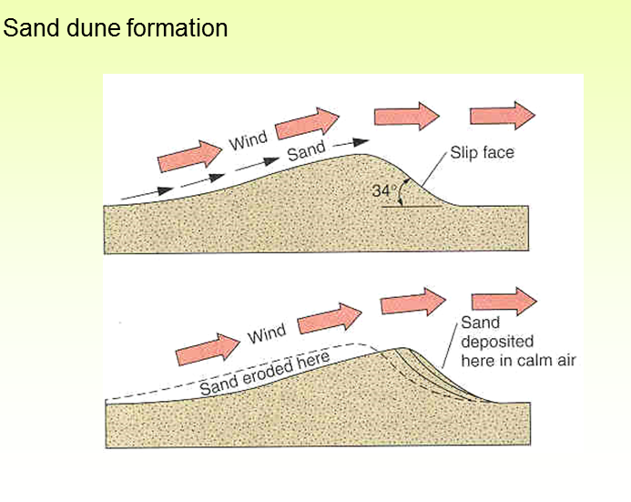
Once sand has been deposited on a beach, it is transported by the wind. When the prevailing wind direction is onshore, the sand gradually migrates landward from the water’s edge. Shallow slopes of sand form, grains move up the slope and are dropped on the steeper lee (“protected”) side of the pile, where the wind velocity is lower. When plants colonize dunes, their roots and stems help to anchor the shifting sand. The structure of plant stems and leaves create small pockets of protection from the wind, causing more sand to accumulate.
It is important to note that sand dunes undergo a continual cycle of erosion (breaking down) and accretion (building up) with the wind and waves. When structures are built so close to a beach as to prevent this natural fluctuation, overall erosion of the beach and loss of dunes can occur. This leaves a shoreline much more vulnerable to damage from storms.
What lives in coastal sand dunes?
Plants and animals that live among sand dunes must be able to tolerate wind, sand abrasion, sand burial, salt spray, water deprivation and constantly shifting sand with low water-holding capacity and little organic matter. These harsh conditions limit the variety of species found in these environments, but surprisingly complex ecosystems still exist in dunes.
One of the first plants to colonize and stabilize newly formed dunes in this area is native dune grass . It normally establishes on the seaward side of coastal dunes.
Other plants found among sand dunes include sand dune bluegrass (Poa macrantha), coastal strawberry (Fragaria chileonsis), seashore lupine (Lupinus littoralis), sand verbena (Abronia spp.), sea rocket (Cakile edentula), seabeach sandwort (Honkenya pepliodes), beach morning glory (Convolvus soldanella), kinnikinnick (Arctostaphylos uva-ursi) and beach pea (Lathyrus japonica). Some of these plants have beautiful flowers.
The animal life of sand dunes is fairly inconspicuous, and includes: amphipods; garter snakes; mammals such as mice and shrews; spiders, and insects such as caterpillars, beetles and flies. Birds such as the endangered Horned Lark (Eremophila alpestris strigata), Semipalmated Plover (Charadrius semipalmatus) and Killdeer nest among sand dunes.
Why are coastal sand dunes important?
Coastal sand dunes form a natural barrier against wind and waves, protecting inland areas from damage due to storms. They also provide habitat for plants and animals, including rare and endangered species. The structure of sand dunes depends largely on stabilizing vegetation such as native dune grass. Without it, the sand would simply blow away, as it does in areas that have been degraded by trampling and invasive species. Sand dunes, as a component of sandy beaches, are also popular recreation areas.
What threatens coastal sand dunes?
Coastal sand dune systems are highly vulnerable to disturbance by trampling. Pedestrians and motor vehicles can compact the sand and crush vegetation; for example, native dune grass dies when its roots are crushed. Without the stabilizing vegetation, the sand is blown away and dunes disappear. This can leave the shoreline more prone to damage from storm surges.
Invasive species are a major concern for the ecology of sand dunes. Scotch broom and European beach grass are two common examples. Because they are not native to the region, they often have no natural predators or other controls, and can create dense monocultures that crowd out other species. As they did not evolve along with all the other species in the area, they provide limited habitat values. Some invasive species are so well-established that their eradication is not feasible without substantial cost and effort.
Sand dunes can be destroyed when structures are built too close to the shoreline. As the coastline naturally erodes, these structures become threatened, and people often respond by building “protective” reinforcements such as seawalls. This can further degrade the beach habitat, and even distant seawalls can starve downdrift beaches of sediment (see coastal sediment processes and altered shorelines).
Dune habitats are often affected by alteration of shorelines in other areas. For example, bluffs composed of glacial till provide sediment that is eroded by waves and transported by longshore currents to the sand dune beach, where it is deposited. If the bluffs are armored to prevent erosion, with cement or rock, this sediment supply is cut off and the beach is gradually depleted of sand.
Sand dunes from Steven Heath
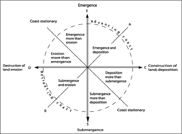
Advancing and Retreating Coasts
|
Eustatic Change
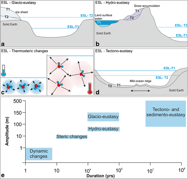
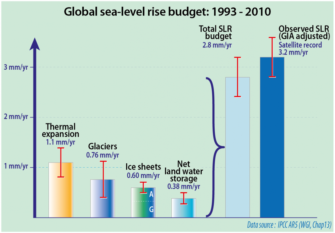
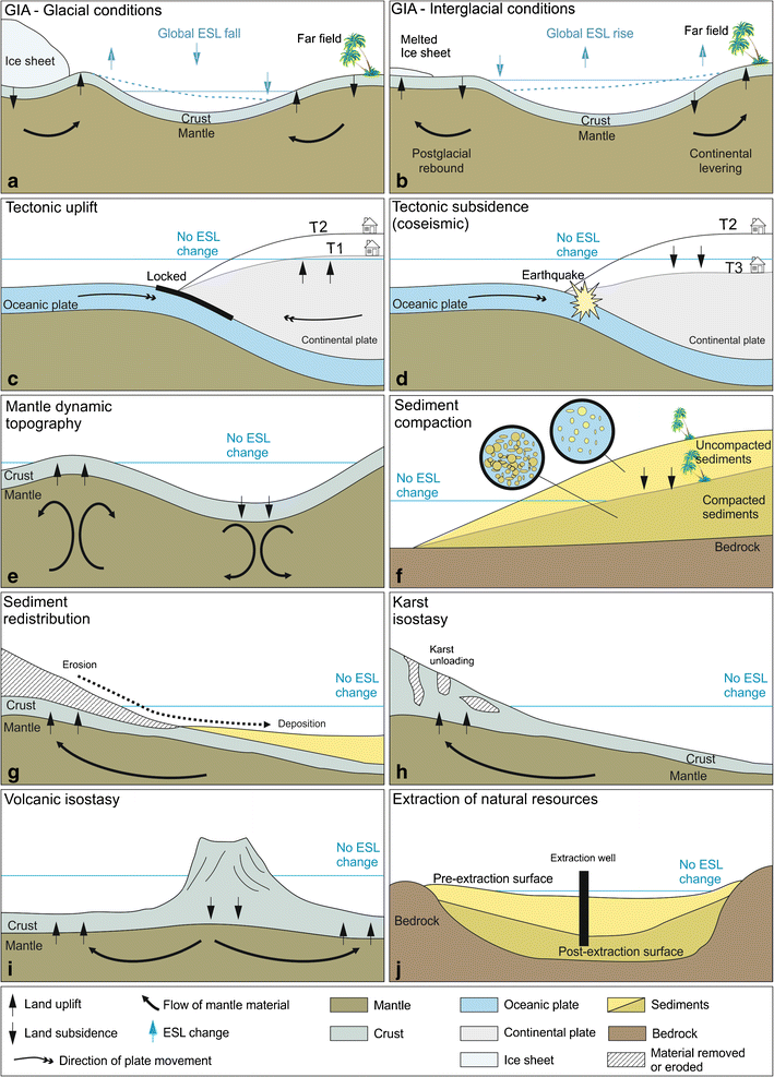
Eustatic change is when the sea level changes due to an alteration in the volume of water in the oceans or, alternatively, a change in the shape of an ocean basin and hence a change in the amount of water the sea can hold. Eustatic change is always a global effect. During and after an ice age, eustatic change takes place. At the beginning of an ice age, the temperature falls and water is frozen and stored in glaciers inland, suspending the hydrological cycle. This results in water being taken out of the sea but not being put back in leading to an overall fall in sea level. Conversely, as an ice age ends, the temperature begins to rise and so the water stored in the glaciers will reenter the hydrological cycle and the sea will be replenished, increasing the sea levels. Increases in temperature outside of an ice age will also effect the sea level since an increasing temperature will cause the ice sheets to melt, putting more water in the sea. The shape of the ocean basins can change due to tectonic movement. If the ocean basins become larger, the volume of the oceans becomes larger but the overall sea level will fall since there’s the same amount of water in the ocean. Conversely, if the ocean basins get smaller, the volume of the oceans decreases and the sea level rises accordingly. |
Isostatic Change
Isostatic sea level change is the result of an increase or decrease in the height of the land. When the height of the land increases, the sea level falls and when the height of the land decreases the sea level rises. Isostatic change is a local sea level change whereas eustatic change is a global sea level change. During an ice age, isostatic change is caused by the build up of ice on the land. As water is stored on the land in glaciers, the weight of the land increases and the land sinks slightly, causing the sea level to rise slightly. This is referred to as compression. When the ice melts at the end of an ice age, the land begins to rise up again and the sea level falls. This is referred to decompression or isostatic rebound. Isostatic rebound takes place incredibly slowly and to this day, isostatic rebounding is still taking place from the last ice age. Isostatic sea level change can also be caused by tectonic uplift or depression. As this only takes place along plate boundaries, this sort of isostatic change only takes place in certain areas of the world. |
Your browser does not support viewing this document. Click here to download the document.
| eustatic_isostatic___relative_sea_level_change.pdf | |
| File Size: | 2969 kb |
| File Type: | |
| Submergent and emergent coastlines | |
| File Size: | 1258 kb |
| File Type: | |
- What are retreating coastlines, and how do they occur?
- What are advancing coastlines, and why do they occur?
- What is the difference between the terms ‘eustatic’ and ‘glacio-eustatic’?
- How typical of the planet’s history are the world’s current sea levels?
- Explain the causes of sea level change.
- Describe the processes that form (a) raised beaches, (b) fjords and (c) rias.
