Please help keep the Geographer Online a FREE resource
Rivers
| rivers.pdf |
Water Cyle

|
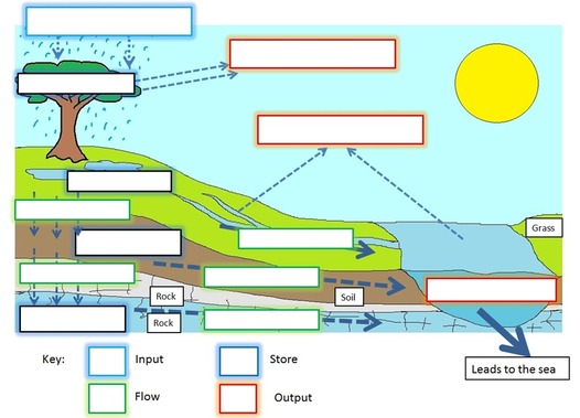
Complete the water cycle diagram and worksheet
| ||
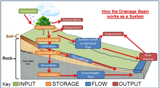
The Drainage Basin as a system
|
How does the water cycle work?
The major stores of water are the ocean, ice caps, land and the atmosphere. The movement of water between these stores is called transfers.
Print and complete the above diagram
|

Drainage Basin
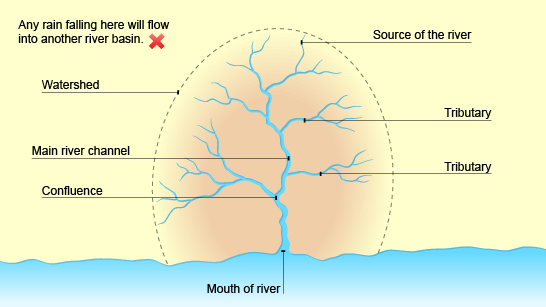
Drainage basin diagram
|

Define the key words on the drainage basin diagram
|
River Processes

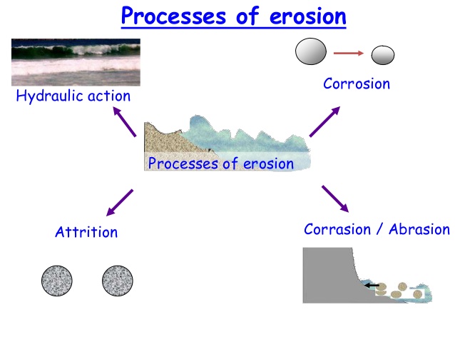
The four types of erosion
Long River profile
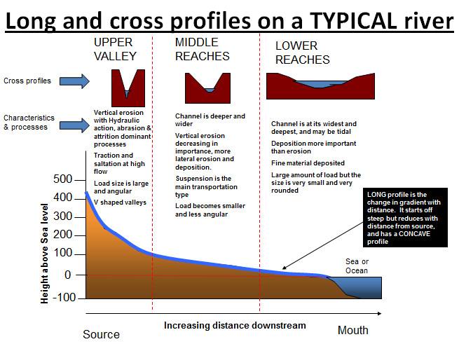
Long River Profile
|
|
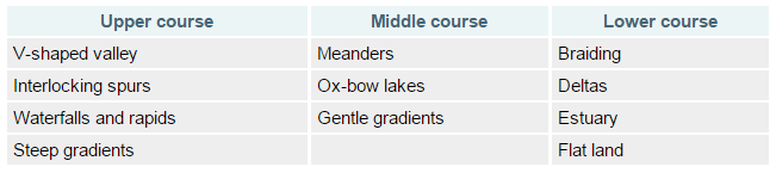
River Features along the river profile
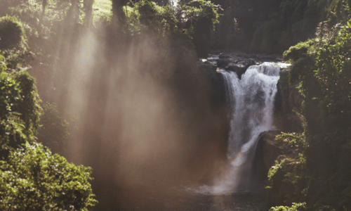
Waterfalls
|
Waterfall diagram
|
|
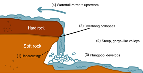
Formation of a waterfall:
|
|
V-Shaped Valleys & Interlocking Spurs
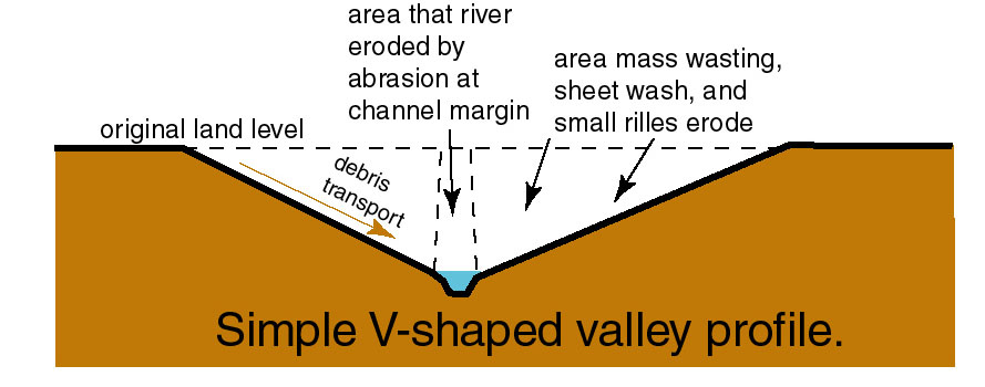
V-Shaped valley diagram
|
When a river is near its source, it often develops a V-shaped valley as the river erodes down (this is called vertical erosion). At the same time, weathering breaks up material on the valley slopes. Weathered material from the valley sides gets deposited in the river. This material is carried by the river and erodes the riverbed through abrasion.
|
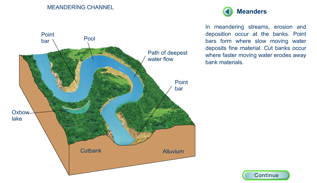
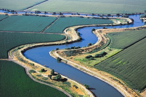
Meanders and Oxbow Lakes
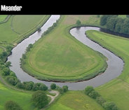
Meander: is a bend in the river. Meanders usually occur in the middle or lower course, and are formed by erosion and deposition.
|
|
|
|
Meander Animations
Meander Animation Link
|
|
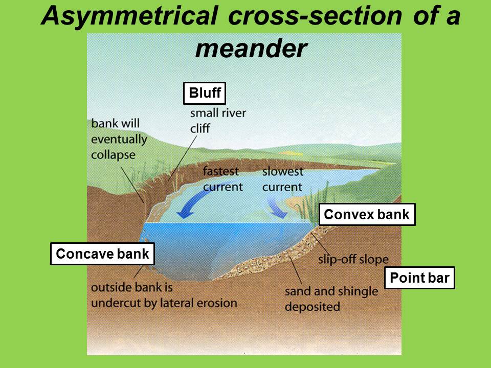
Meander cross section
|
|
Floodplains

|
Watch the following animation and explain: What are floodplain and how do they form?
|
Levees
|
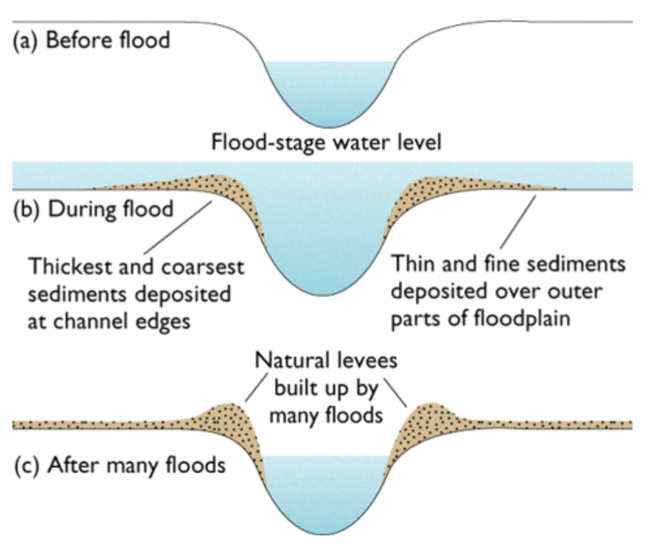
Levee diagram
|
River Deltas

|

Print and complete the River Delta Worksheet
| ||
Why do people live near rivers?
Benefits
Floodplains are dynamic natural systems. The natural processes of periodic flooding, accompanied by erosion and deposition, bring changes to the topography, soils, vegetation, and physical features (such as meanders, braided channels and oxbow lakes) within these areas over time.
Floodplains provide a wide range of benefits to the ecosystem and community that include:
- Flood storage and erosion control–offer a broad area for streams and rivers to spread out and accommodate temporary storage of flood water, reducing flood peaks and erosion potential
- Water quality maintenance – reducing sediment loads, filtering nutrients and impurities, and moderating water temperature
- Groundwater recharge
- Biological productivity – providing fertile soils with high rate of plant growth and diversity, richer agricultural harvests, and healthier forests
- Habitat for a variety of fish and wildlife, including rare and endangered species
- Recreational opportunities – providing areas for active and passive activities, supporting the economic base
- Open space
Causes of Floods
| Storm Hydrograph |

River Management Strategies

|
Using the following three websites create a table listing, describing and explaining the possible management strategies for rivers and their floodplains. Separate them into Hard and Soft Engineering strategies.
|
River Flood Case STudy

|
Case Study: Mississippi River
|
|
|
|
|
|
|
|
|
| case_study_mississippi.pdf |
