Please help keep the Geographer Online a FREE resource
Maps - Introduction
- To be able to locate a country using its latitude and longitude
- To be able to identify countries using an atlas
- To know how to follow a path set out by the lines of latitude and longitude

Watch the following Video and try to discover as many ways as you can about how maps are used.
|
|
|

Main:

|
| ||||
Using the worksheet on lines of latitude and longitude mark on the various volcanoes on our planet. You can then check them using your Atlas.
| Famous Volcanoes Location - Worksheet |
How we make maps

- To know what a good map should have
- To know the compass directions
- To be able to use a map to tell directions

Mental Mapping: Draw a map of your neighborhood (where you live). It should be focused on your own house. It should be completed on one page of your notebook and include as many aspects of a map that you can think of. (15 min)

Main:
Give out OS maps (1 per table) . Ask the students to discuss and compare their maps to the OS maps and to think of the different features maps should have to be useful.
Give out OS maps (1 per table) . Ask the students to discuss and compare their maps to the OS maps and to think of the different features maps should have to be useful.
- Title
- Scale
- Grid
- Key (symbols)
- Colours
- Compass direction
|
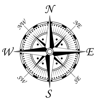
Compass:
Draw a compass and explain the directional points. |
|
Using the OS maps on the desk give compass directions to different things on the maps. Test the students in their sense of direction using the revision Kahoot.
| |||
Maps: Scale & Distance

- To be able to measure straight line and real distance


Using the Slide Share explain scale and distance. Then complete the following worksheet.
| How Far? Worksheet |
| Measuring Scale and Distance |
Go over the the worksheet questions in class and correct the answers that they have so far.
Can be completed for Homework
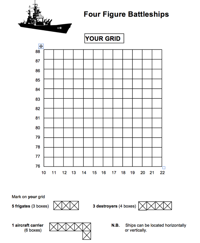
Maps: Grid references

- To be able to read 4-figure and 6-figure references.
- To know how to mark points using grid references.

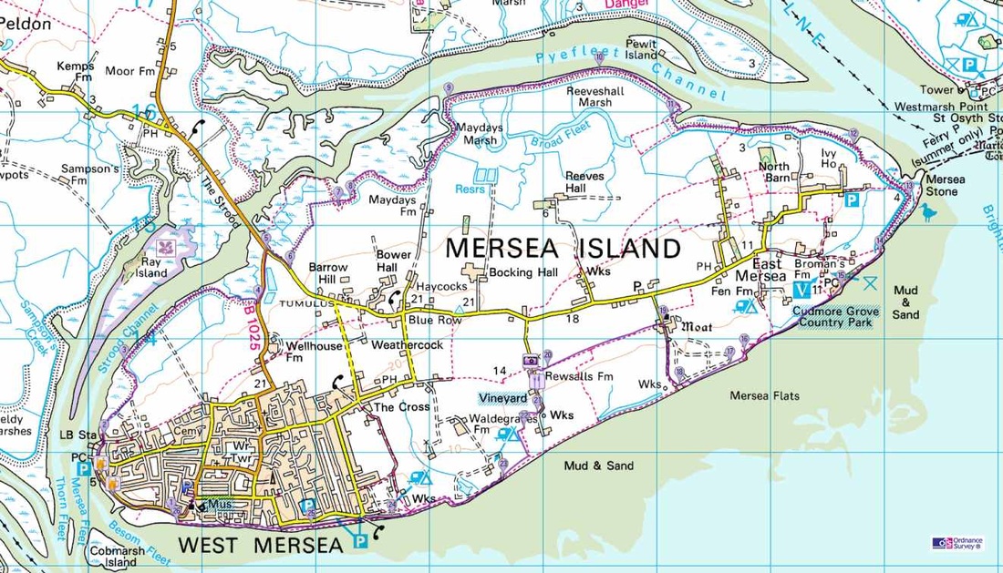
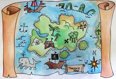
Display the Treasure map below and ask students to imagine they are pirates and have buried treasure. They then need to write down some cryptic directions to exactly where that treasure is buried- they are only allowed 4 words! We will then try to find the exact location.
(this will prove to be difficult, leading nicely into the reason for grid references)


- Using the PowerPoint run through explanation and exercises about Grid References.
- Complete the work sheet explaining how to work out Grid References (complete for Homework and colour it in)
|
| ||||
| Extension task - Grid references |

Play the battleships game with the class - display it on the board and have them guess coordinates for my battle ships.
|
| ||
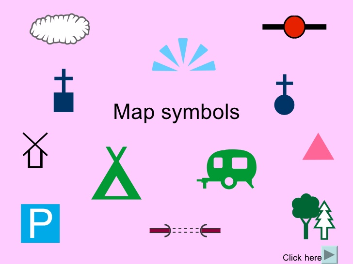
Maps: Symbols
- To know a range of map symbols
- To be able to use a key

Using the two images below try to identify what or where certain symbols are.
|
|

- Using the PowerPoint and the OS map extract discover what are map symbols and how we use them.
- Make notes on how to read a key.
- Complete the worksheet on symbols.
|
|
| ||||||
Height on a map.
- To understand how height and shape are shown on a map
- To know that three different techniques can be used – spot heights, layer colouring and contours

Watch the YouTube below and try to work out what contour lines are. Discuss in class, what are their uses?

Make some notes on what contour lines are and practice reading them using OS Map.

Contour Map

Using the outline map below and cardboard, create a 3D elevation map of Enchanted Rock
(this activity will take up to 2 lessons)
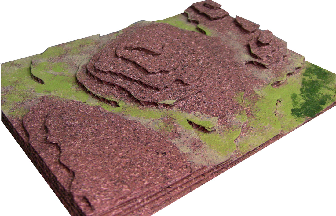
Enchanted Rock State Natural Area, Texas
|
| ||

Using the 3D maps compare them to the contour line map of the area and the Google World image and try to recognize certain features and points.
Map Skills Assessment
|
Treasure Map Project
This will be counting as your end of unit assessment.
| ||||||
Extension Task: Geography in the News

This task is going to be a paired assignment using IT to both practice connecting through Office 365 and also using some of the programs that are available to you.
Creating a news report
Programs to use:
|
|
