THE GEOGRAPHER ONLINE

My Place

  • Home
    • How to make a website: Tools and experiences
    • Maps and Regions
    • Travel Photographs and Videos
    • Live: Global Hazards and Disasters
    • Geography in the news
    • The Big Geography Challenge
  • New IB Geography 2017 onwards
    • IB Geography Introduction
    • Part 1: Geographical Themes >
      • Option B: Oceans and coastal margins >
        • 1. Ocean–atmosphere interactions
        • 2. Interactions between oceans and coastal places
        • 3. Managing coastal margins
        • 4. Ocean management futures
      • Option D: Geophysical Hazards >
        • 1. Geophysical systems
        • 2. Geophysical hazard risks
        • 3. Hazard risk and vulnerability
        • 4. Future resilience and adaptation
    • Part 2: Core Units (SL&HL) >
      • Unit 1: Changing Population >
        • 1. Population and economic development patterns
        • 2. Changing Populations and Places
        • 3. Challenges and opportunities
      • Unit 2: Global climate—vulnerability and resilience >
        • 1. Causes of global climate change
        • 2. Consequences of global climate change
        • 3. Responding to global climate change
      • Unit 3: Global resource consumption and security >
        • 1: Global trends in consumption
        • 2: Impacts of changing trends in resource consumption
        • 3: Resource stewardship
    • Part 3: HL Core Extensions >
      • Unit 4: Power, places and networks >
        • 1. Global interactions and global power
      • Unit 5: Human development and diversity
      • Unit 6: Global risks and resilience
    • Internal Assessment
    • Why should I study IB Geography?
  • IB Geography (Old Syllabus)
    • IB Core >
      • 1. Populations in Transition
      • 2. Disparities in Wealth and Development
      • 3. Patterns in Environmental Quality and Sustainability
      • 4. Patterns in Resource Consumption
    • Part 1: Geographical Themes >
      • Oceans and their Coastal Margins
      • Hazards and disasters - risk assessment and response
      • Freshwater - issues and conflicts
      • Urban Environments
    • Global Interactions - HL >
      • Measuring Global Interactions
      • Changing Space - The Shrinking world
      • Economic Interactions and Flows
      • Environmental Change
      • Sociocultural Exchanges
      • Political Outcomes
      • Global Interactions at the Local Level
    • IB Guidance >
      • Syllabus Guidance
      • IB Examination Guidance
    • Extended Essay
  • IGCSE Geography
    • Theme 1: Population and settlement >
      • Population Dynamics
      • Migration
      • Settlements
      • Urban Settlements
      • Urbanisation
    • Theme 2: The natural environment >
      • Plate Tectonics
      • Coasts
      • Rivers
      • Weather and Climate
      • Climate and Ecosystems
    • Theme 3: Economic development >
      • Development
      • Food Production
      • Industry
      • Energy
      • Tourism
      • Water
      • Environmental Risks of Economic development
    • GCSE Key Terms
    • GCSE Coursework
    • Alternative to Coursework
    • IGCSE Geography Examination Advice
    • IGCSE Revision Games
  • Key Stage 3
    • Year 6 >
      • My Place
      • Rivers
      • Brazil
    • Year 7 >
      • Maps and the world
      • Rocky Landscapes
      • Settlement
      • Weather & Climate
    • Year 8 >
      • Maps Introduction
      • Plate Tectonics
      • Economic Activity
      • Biomes
    • Year 9 >
      • Map Skills - review
      • Development
      • Coasts
      • Tourism
      • Paradise lost - Tourism in Thailand
  • AS Level Geography
    • World at Risk
    • Crowded Coasts
  • Geography Skills
  • Donations & Contact
  • YouTube Channel
  • Essential computer programs

Lesson 1: Introducing Geography

Picture
​•To know what the study of geography involves. 
•To understand the difference between physical and human geography and where they overlap, environmental geography. 
•To be able to classify different topics into these categories

Picture
Using the handout below, play a game of 'Global Bingo'. There will be a credit for the person who finishes first! You are not allowed to use information from the same person.
Global Bingo
File Size: 167 kb
File Type: doc
Download File


Picture
Watch the video below - why do you think Geography is important? Leave one blank space in your notebook. Discuss why geography is important and create a spider diagram of reasons that you can think of. 

Picture
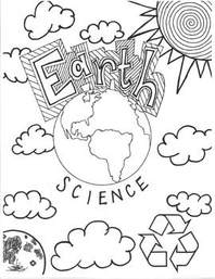
Create a cover page to introduce geography. It needs to be colourful, well designed and contain many aspects of what we will study in geography this year. 
Picture
Cover page example

Lesson 2: Geographical facts

Picture
  • To practice finding geographical facts.
  • To explore different parts of the world.
  • To be able to follow 'hints' and discover answers.

Picture
Watch the following video and see if you can answer the questions? What is your Geographical knowledge like?

Picture
Create small teams (maximum 4 people). Using the worksheet below, see if you can follow the hints to find answers to the questions. You may use 2 laptops per group.
Geographical knowledge race
File Size: 21 kb
File Type: docx
Download File


Picture
Game: Can you name a country that begins with every letter of the alphabet? 

Lesson 3: Introduction to Maps

Picture
  • To know what a map is and how it can show your place
  • To understand what is meant by STACK
  • To be able to create a simple map and be able to STACK it

Picture
Place is very important to our identity…
  • Why?
  • How about where you live?
  • How about your school?
  • So how could you show your route to school?
  • Try drawing it WITHOUT using any full words
  • Now swap with someone else – could they understand how to travel that route without you explaining it?

Picture
Introducing maps - Year 6 from Steven Heath
Introducing maps
File Size: 2153 kb
File Type: pptx
Download File

Hand outline for STACK
File Size: 49 kb
File Type: docx
Download File


Picture

​Short question and answer session on the knowledge that we have learnt today.

Lesson 4: Our globe - Oceans and Continents

Picture
  • To understand the differences between maps and globes; continents and oceans.
  • To be able to complete an atlas map using the principles of STACK.
  • To be able to use the new vocabulary in sentences about our globe. 

Picture
How good is your knowledge of the country that you live in? Can you identify places? Using Geoguessr Challenge the class to see how good they are.
Geoguessr

Picture
Using the worksheets below label the continents and oceans of the world. Also place your country in context of where it is on our planet. Add the important lines and define the key new terms.
Oceans and Continents Worksheet
File Size: 161 kb
File Type: docx
Download File

China's location in the world
File Size: 77 kb
File Type: doc
Download File

Map: A map is a 2-dimensional (flat), diagrammatical (picture) representation of an area.  They are drawn to scale. 
Globe: A sphere shaped model which represents the Earth
Continent: These are the 7 large land masses that make up the Earth e.g. Asia. They include countries. 
Ocean: A large body of water e.g. the Pacific.
Equator: An imaginary line that divides our planet into two hemispheres
Border: An boundary that divides one country from another. 

Picture
Continents of the world
Picture
Oceans of the world

Picture
Review the Oceans and continets of our world by playing the following game.
Oceans and continets game

Lesson 5 & 6: Extreme world Geography

Picture
  • To know the most extreme/biggest physical and human features of the world
  • To recognise the locations of these places
  • To be able to construct a map of these using the principles of STACK
  • To use simple sentences to describe locations

Picture
See if you can identify these famous places around the world?
Geoguessr

Picture
Using the information on the slide share complete the tasks
The world's largest and biggest from Steven Heath
The world
File Size: 1337 kb
File Type: ppt
Download File

World Map Outline
File Size: 302 kb
File Type: jpg
Download File


Picture
Review knowledge for a brief test at the end of the two lessons
Largest and biggest
Longest rivers
Most populated cities

Lesson 7: Representing my place: Field Sketches

Picture
  • ​To know the main features of my place
  • To understand how to represent them on a field sketch
  • To be able to create my own field sketches

Picture
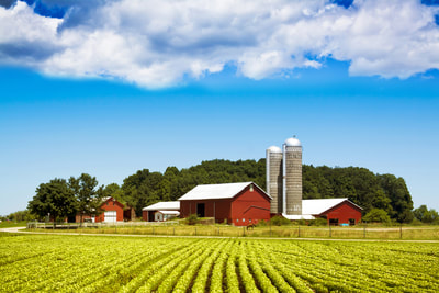
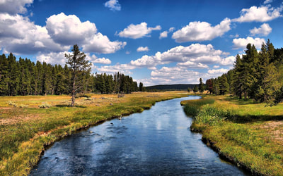
Look carefully at the images below and try to identify what the important Geographical features are of each photo. 

Picture
Go through the activities on the PowerPoint and practice drawing your own field sketch.
Field sketches and how to draw them from Steven Heath
Field Sketches and how to draw them
File Size: 471 kb
File Type: ppt
Download File


Picture
Peer assess each others field sketches:
​

Lesson 8: The country we live in, how is it represented?

Picture
  • To know what is meant by ‘representations’
  • To understand how China might be represented
  • To be able to reflect on what represents China for me

Picture
Using Plickers - conduct a short quiz (poll) to determine how 'Chinese' the class feels.
Button Text

Picture
Follow the instructions on the NearPod presentation - to be done as an interactive exercise on students' laptops. 

Lesson 9: Why is Beijing amazing?

Picture
  • To recognize some of the attributes that people find good about Beijing.
  • To learn how to use persuasive writing to support your ideas.

Picture
Watch the stimulus video for ideas about why Beijing is considered such a desirable city to visit. You will need to consider what also makes it desirable to live in.

Picture
Picture
FlipGrid
Create a 1 min 30 second persuasive video encouraging someone to come and live in Beijing. You will need to structure this correctly and before you record the video you will need to write down your ideas in your notebook. 
  • Where should they live?
  • Why should they come here?
  • What benefits are there?
  • Why will they like it?
  • You should talk about all the things that you think are positive about the city that we live in.

Lesson 10: People around the world - Questionnaire 

Picture
  • To know how you are connected to other places
  • To understand that there are a range of links
  • To be able to design and implement a questionnaire to discover these links

Picture

​​How could you find out more about people’s connections to the world? Brainstorm ideas. 

Picture
Using Microsoft 365 Forms:
Design a questionnaire to find out where people are from and how they are connected to other places
  • What makes a good questionnaire?
  • What is the difference between closed and open questions?
  • What are the advantages/disadvantages of each?
  • What else do we need to think about when writing questionnaires?
  • What else do we need to think about when asking questionnaires?

Picture
Send out the form to one person in the class and complete their questionnaire. Feedback on experience of answering questions. 
www.thegeographeronline.net
Picture
The Geographer Online is an educational website aimed at providing geography teaching resources for all levels. 
Created and Developed by: Steven Heath

Follow us!
Creative Commons Licence
This work is licensed under a Creative Commons Attribution-NonCommercial-ShareAlike 4.0 International License.
  • Home
    • How to make a website: Tools and experiences
    • Maps and Regions
    • Travel Photographs and Videos
    • Live: Global Hazards and Disasters
    • Geography in the news
    • The Big Geography Challenge
  • New IB Geography 2017 onwards
    • IB Geography Introduction
    • Part 1: Geographical Themes >
      • Option B: Oceans and coastal margins >
        • 1. Ocean–atmosphere interactions
        • 2. Interactions between oceans and coastal places
        • 3. Managing coastal margins
        • 4. Ocean management futures
      • Option D: Geophysical Hazards >
        • 1. Geophysical systems
        • 2. Geophysical hazard risks
        • 3. Hazard risk and vulnerability
        • 4. Future resilience and adaptation
    • Part 2: Core Units (SL&HL) >
      • Unit 1: Changing Population >
        • 1. Population and economic development patterns
        • 2. Changing Populations and Places
        • 3. Challenges and opportunities
      • Unit 2: Global climate—vulnerability and resilience >
        • 1. Causes of global climate change
        • 2. Consequences of global climate change
        • 3. Responding to global climate change
      • Unit 3: Global resource consumption and security >
        • 1: Global trends in consumption
        • 2: Impacts of changing trends in resource consumption
        • 3: Resource stewardship
    • Part 3: HL Core Extensions >
      • Unit 4: Power, places and networks >
        • 1. Global interactions and global power
      • Unit 5: Human development and diversity
      • Unit 6: Global risks and resilience
    • Internal Assessment
    • Why should I study IB Geography?
  • IB Geography (Old Syllabus)
    • IB Core >
      • 1. Populations in Transition
      • 2. Disparities in Wealth and Development
      • 3. Patterns in Environmental Quality and Sustainability
      • 4. Patterns in Resource Consumption
    • Part 1: Geographical Themes >
      • Oceans and their Coastal Margins
      • Hazards and disasters - risk assessment and response
      • Freshwater - issues and conflicts
      • Urban Environments
    • Global Interactions - HL >
      • Measuring Global Interactions
      • Changing Space - The Shrinking world
      • Economic Interactions and Flows
      • Environmental Change
      • Sociocultural Exchanges
      • Political Outcomes
      • Global Interactions at the Local Level
    • IB Guidance >
      • Syllabus Guidance
      • IB Examination Guidance
    • Extended Essay
  • IGCSE Geography
    • Theme 1: Population and settlement >
      • Population Dynamics
      • Migration
      • Settlements
      • Urban Settlements
      • Urbanisation
    • Theme 2: The natural environment >
      • Plate Tectonics
      • Coasts
      • Rivers
      • Weather and Climate
      • Climate and Ecosystems
    • Theme 3: Economic development >
      • Development
      • Food Production
      • Industry
      • Energy
      • Tourism
      • Water
      • Environmental Risks of Economic development
    • GCSE Key Terms
    • GCSE Coursework
    • Alternative to Coursework
    • IGCSE Geography Examination Advice
    • IGCSE Revision Games
  • Key Stage 3
    • Year 6 >
      • My Place
      • Rivers
      • Brazil
    • Year 7 >
      • Maps and the world
      • Rocky Landscapes
      • Settlement
      • Weather & Climate
    • Year 8 >
      • Maps Introduction
      • Plate Tectonics
      • Economic Activity
      • Biomes
    • Year 9 >
      • Map Skills - review
      • Development
      • Coasts
      • Tourism
      • Paradise lost - Tourism in Thailand
  • AS Level Geography
    • World at Risk
    • Crowded Coasts
  • Geography Skills
  • Donations & Contact
  • YouTube Channel
  • Essential computer programs